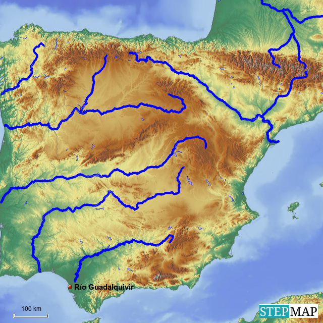
The intricate network of rivers, lakes, and coastlines defines the rich natural landscape of Spain. For those interested in studying this vital aspect of Spanish geography, the Spain hydrographic map is an essential resource. This map is available for free printing or downloading, making it accessible for educators, students, and enthusiasts alike.
Understanding Spain’s Hydrography
Spain’s hydrographic system plays a crucial role in its climate and agriculture. Water bodies can be categorized into several types:
- Rivers: Major rivers like the Ebro and the Guadalquivir are key to irrigation and transport.
- Lakes: While fewer in number, lakes such as Lake Sanabria boast ecological significance.
- Coastlines: With a vast coastline along the Mediterranean Sea and the Atlantic Ocean, these areas are vital for tourism and fishing.
Significance of Hydrographic Mapping
Understanding the hydrography of Spain aids in various fields such as environmental science, geography, and urban planning. The Spain hydrographic map can help researchers identify patterns in water distribution and its impacts on local ecosystems.
Find the Spain hydrographic map available for free in this article.