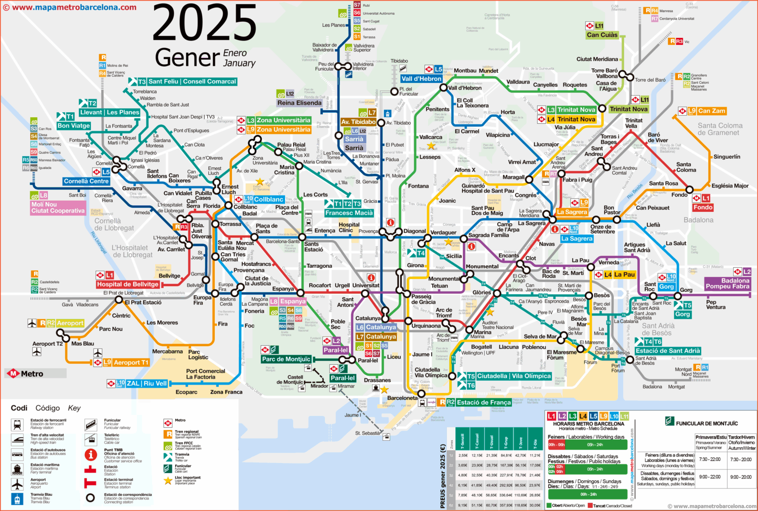
Navigating a bustling city can be daunting, but having the right tools makes all the difference. The Barcelona public transport map is essential for anyone looking to explore this vibrant city. Available for free download or printing, this map ensures you can easily traverse Barcelona’s extensive transport network.
Why Use the Public Transport System?
Barcelona is the capital of Catalonia, and it boasts an efficient public transport system that includes buses, trams, and metro services. Utilizing public transport can help you save time and avoid the stress of city driving.
Key Features of Barcelona’s Public Transport
- Metro: Offers extensive coverage across the city with 12 lines.
- Buses: Serves as a reliable option with numerous routes throughout Barcelona.
- Trams: Connects key areas and provides a scenic way to travel.
With diverse options and reliable schedules, navigating Barcelona has never been easier. For those planning to visit, the Barcelona public transport map is a vital resource you can find right here.