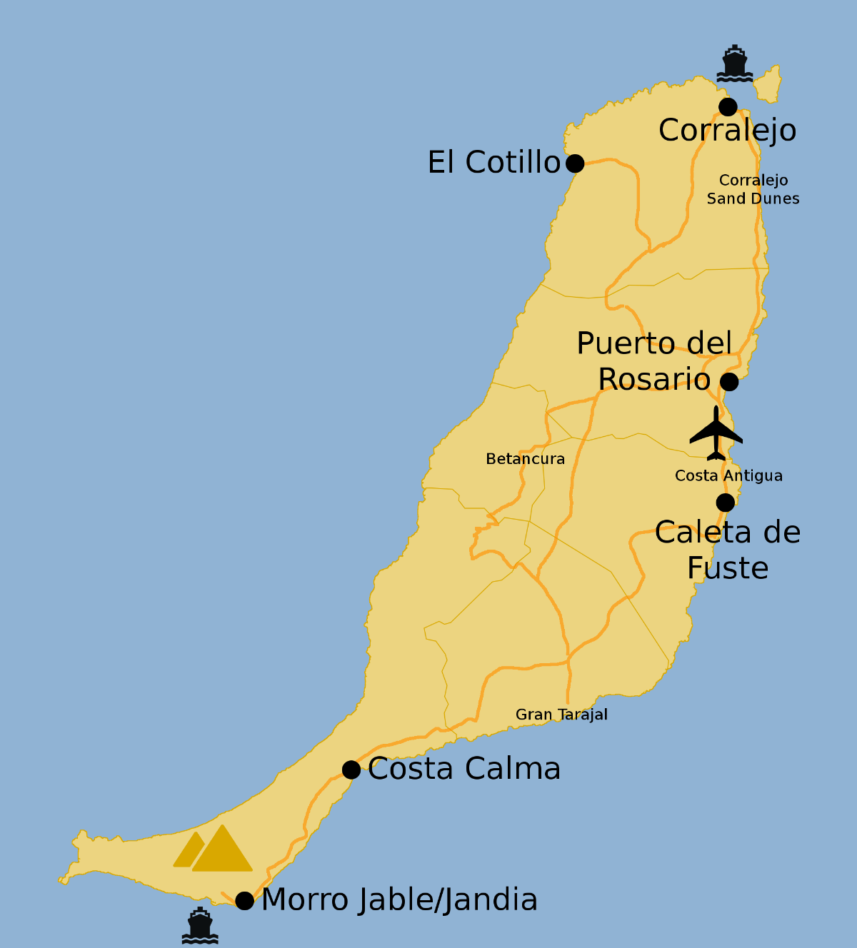
Looking for a comprehensive guide to navigating Fuerteventura? The Fuerteventura Airport map is essential for travelers aiming to make the most of their journey on this stunning island. Available for free, you can easily print or download the map to have it on hand during your travels.
Why Fuerteventura?
Fuerteventura is one of the Canary Islands, an autonomous community of Spain, known for its breathtaking beaches, crystal-clear waters, and year-round pleasant climate. It’s a paradise for water sports enthusiasts, especially those who enjoy windsurfing and kitesurfing.
Airport Information
- Fuerteventura Airport (FUE) is situated near the capital, Puerto del Rosario.
- The airport serves both domestic and international flights, with connections to major European cities.
- Facilities include car rental services, restaurants, and shops.
What to See Nearby
Visitors can explore various attractions close to the airport, including:
- Beautiful beaches like Playa de Sotavento and Playa de Jandía.
- Natural parks such as Corralejo Dunes National Park.
- Charming local villages and markets.
For the Fuerteventura Airport map, keep reading below to access your free download!