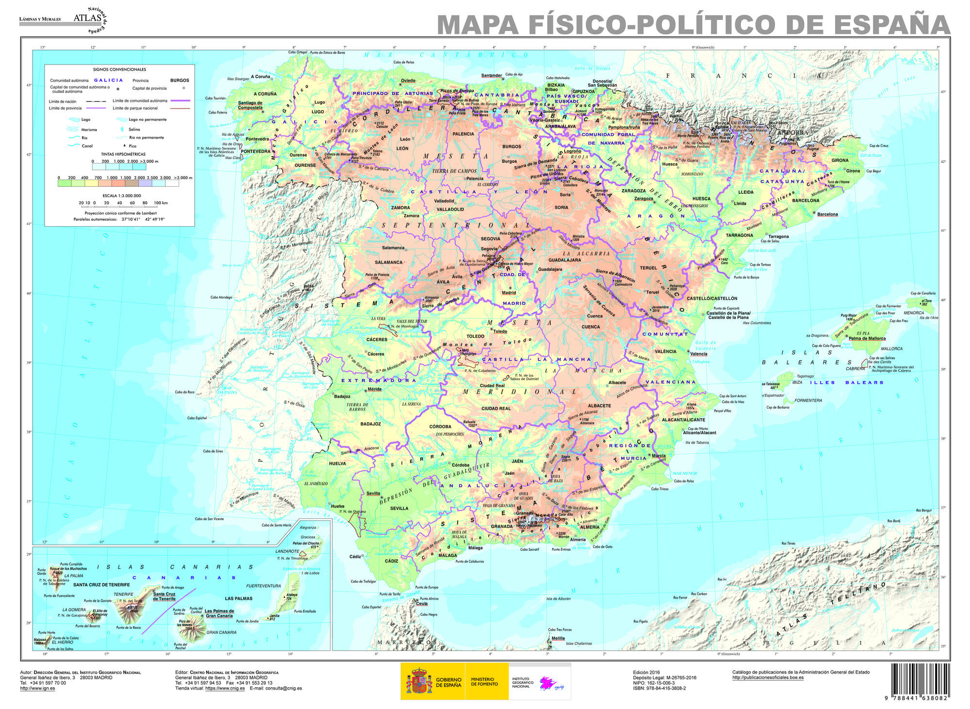
Maps of Spain offer a rich visual representation of the country’s diverse landscapes and regions. The Spain physical map is an essential tool for anyone interested in the topography, geography, and natural features of this beautiful country. You can print or download it for free to enhance your knowledge of Spain’s terrain.
Topographical Features
The geography of Spain is remarkably diverse, featuring mountains, plains, and coastal regions. Here are some notable geographical highlights:
- The Pyrenees: A mountain range that forms a natural border with France.
- Meseta Central: A vast plateau that dominates the central part of the country.
- Andalusian Coast: Known for its beautiful beaches and warm climate.
Cities and Regions
Spain is divided into various territories including autonomous communities, provinces, and cities. Some prominent cities include:
- Madrid: The capital, located in the center of the country.
- Barcelona: Renowned for its architecture and Mediterranean vibe.
- Valencia: Famous for its arts, science, and beaches.
The Spain physical map is available to view and access here.