Spain is home to diverse landscapes and rich cultures, making it an intriguing subject of study. One way to understand its complexities is through a Spain population density map, which provides insights into how people are distributed across various regions. This resource is available for free download or printing.
Understanding Population Density in Spain
Key Insights
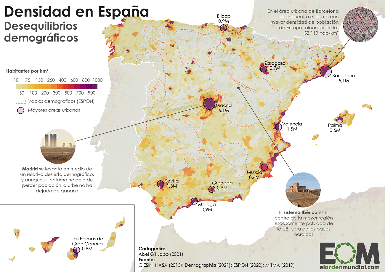
The Spain population density map illustrates how densely populated areas contrast with more rural regions. Key facts include:
- Madrid, as the capital, shows high density.
- Barcelona, a major urban center, also ranks high in population concentration.
- Regions like Extremadura present a much lower density, offering vast open spaces.
Regions of Interest
Spain’s diverse regions contribute to varying population densities. For example, Andalusia, a large autonomous community, features both bustling cities and serene countryside. In contrast, Ceuta and Melilla are Spanish autonomous cities located on the coast of North Africa, each showcasing unique demographic patterns.
Visitors can explore the Spain population density map to visualize these differences and gain a deeper understanding of the country’s demographic landscape.